


Voting District 0791700000001, Kalkaska County, Michigan
About
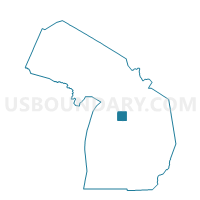
Outline

Summary
| Unique Area Identifier | 597245 |
| Name | Voting District 0791700000001 |
| County | Kalkaska County |
| State | Michigan |
| Area (square miles) | 36.27 |
| Land Area (square miles) | 34.51 |
| Water Area (square miles) | 1.76 |
| % of Land Area | 95.15 |
| % of Water Area | 4.85 |
| Latitude of the Internal Point | 44.81176000 |
| Longtitude of the Internal Point | -85.03331150 |
Maps


Graphs
Select a template below for downloading or customizing gragh for Voting District 0791700000001, Kalkaska County, Michigan


Neighbors
Neighoring Voting District (by Name) Neighboring Voting District on the Map
- Voting District 0091940000001, Antrim County, MI
- Voting District 0095064000001, Antrim County, MI
- Voting District 0095064000002, Antrim County, MI
- Voting District 0790644000001, Kalkaska County, MI
- Voting District 0790932000001, Kalkaska County, MI
- Voting District 0792686000001, Kalkaska County, MI
- Voting District 0794228000001, Kalkaska County, MI
- Voting District 0796718000001, Kalkaska County, MI
Top 10 Neighboring County Subdivision (by Population) Neighboring County Subdivision on the Map
- Kalkaska township, Kalkaska County, MI (4,722)
- Mancelona township, Antrim County, MI (4,400)
- Coldsprings township, Kalkaska County, MI (1,464)
- Rapid River township, Kalkaska County, MI (1,145)
- Custer township, Antrim County, MI (1,136)
- Excelsior township, Kalkaska County, MI (953)
- Bear Lake township, Kalkaska County, MI (667)
- Blue Lake township, Kalkaska County, MI (387)
Top 10 Neighboring Place (by Population) Neighboring Place on the Map
Top 10 Neighboring Unified School District (by Population) Neighboring Unified School District on the Map
Top 10 Neighboring State Legislative District Lower Chamber (by Population) Neighboring State Legislative District Lower Chamber on the Map
Top 10 Neighboring State Legislative District Upper Chamber (by Population) Neighboring State Legislative District Upper Chamber on the Map
Top 10 Neighboring 111th Congressional District (by Population) Neighboring 111th Congressional District on the Map
Top 10 Neighboring Census Tract (by Population) Neighboring Census Tract on the Map
- Census Tract 9607, Antrim County, MI (5,000)
- Census Tract 9502, Kalkaska County, MI (4,895)
- Census Tract 9605, Antrim County, MI (3,212)
- Census Tract 9506.01, Kalkaska County, MI (2,039)
- Census Tract 9506.02, Kalkaska County, MI (1,760)